

+
+
+
At GeoSurveys, we understand that effective data management is essential to the success of any 2D or 3D Ultra High Resolution Seismic (UHRS) project. Our approach ensures that all data—from acquisition to final interpretation—is handled with precision, security, and full traceability.
We implement robust data management workflows tailored to each project's scale and complexity, enabling seamless integration between acquisition, processing, and interpretation phases. Our infrastructure supports the secure storage, version control, and rapid access of large datasets, while maintaining data integrity throughout the project lifecycle.
Our UHRS data management services include:
With GeoSurveys, clients can rely on a streamlined, transparent, and secure data environment—ensuring that every piece of information is accessible, traceable, and ready to support decision-making at any stage.
At GeoSurveys, our approach to 2D and 3D Ultra High Resolution Seismic (UHRS) extends beyond acquisition and processing—delivering not only exceptional resolution and penetration, but also actionable geological insight.
We ensure that UHRS data supports reliable, high-quality interpretation results. Our team of experienced geologists specializes in geological and structural interpretation, with proven expertise in mapping subsurface features and identifying geo-hazards.
From detailed stratigraphic analysis to fault and risk zone identification, we transform seismic data into meaningful insights—empowering clients to make informed decisions with confidence.
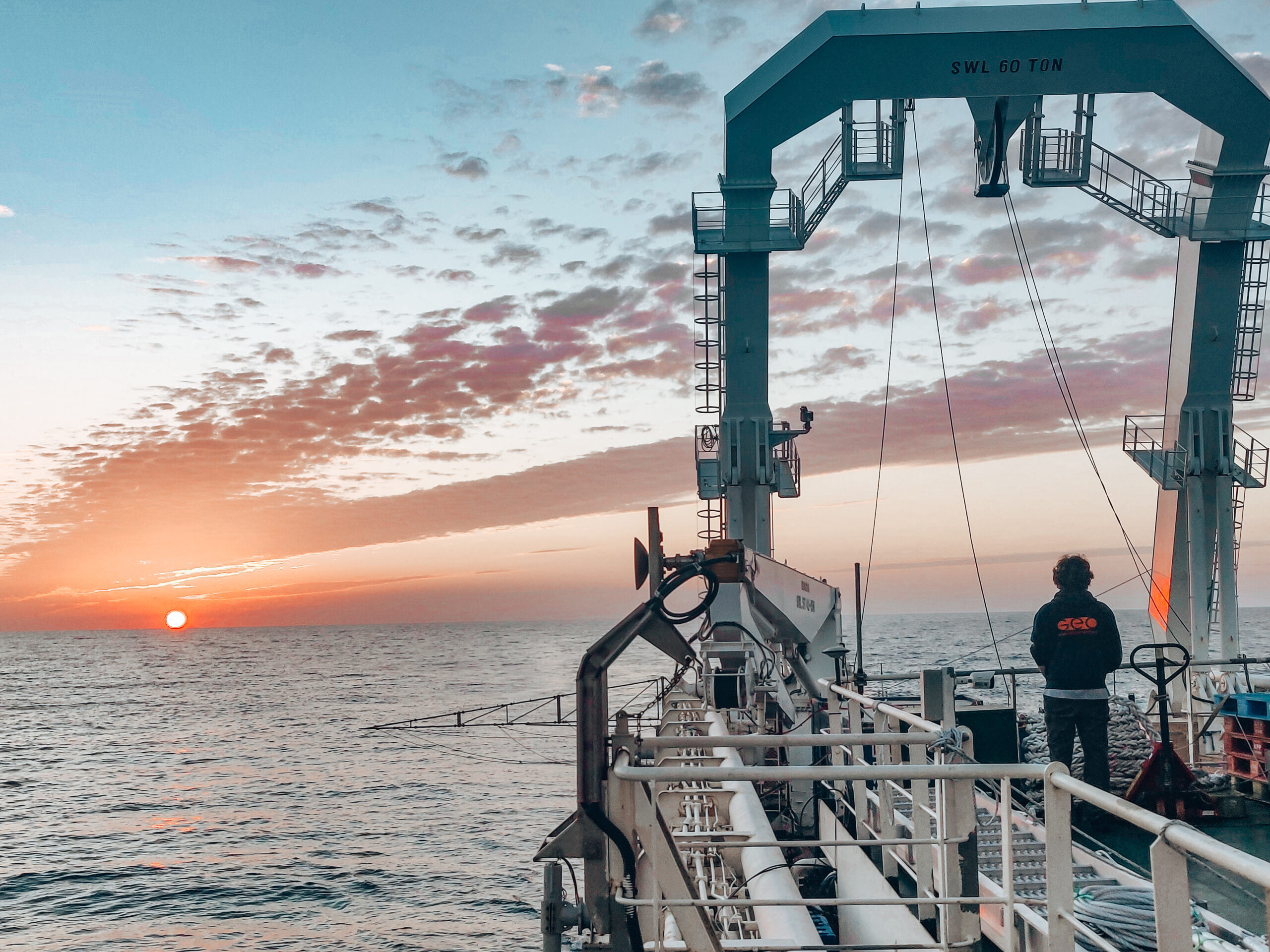
GeoSurveys is committed to supporting clients from the earliest stages of each project. Leveraging extensive industry experience, our team excels in the design, planning, and execution of complex geophysical surveys—ensuring the delivery of high-quality data that maximizes value for our clients.
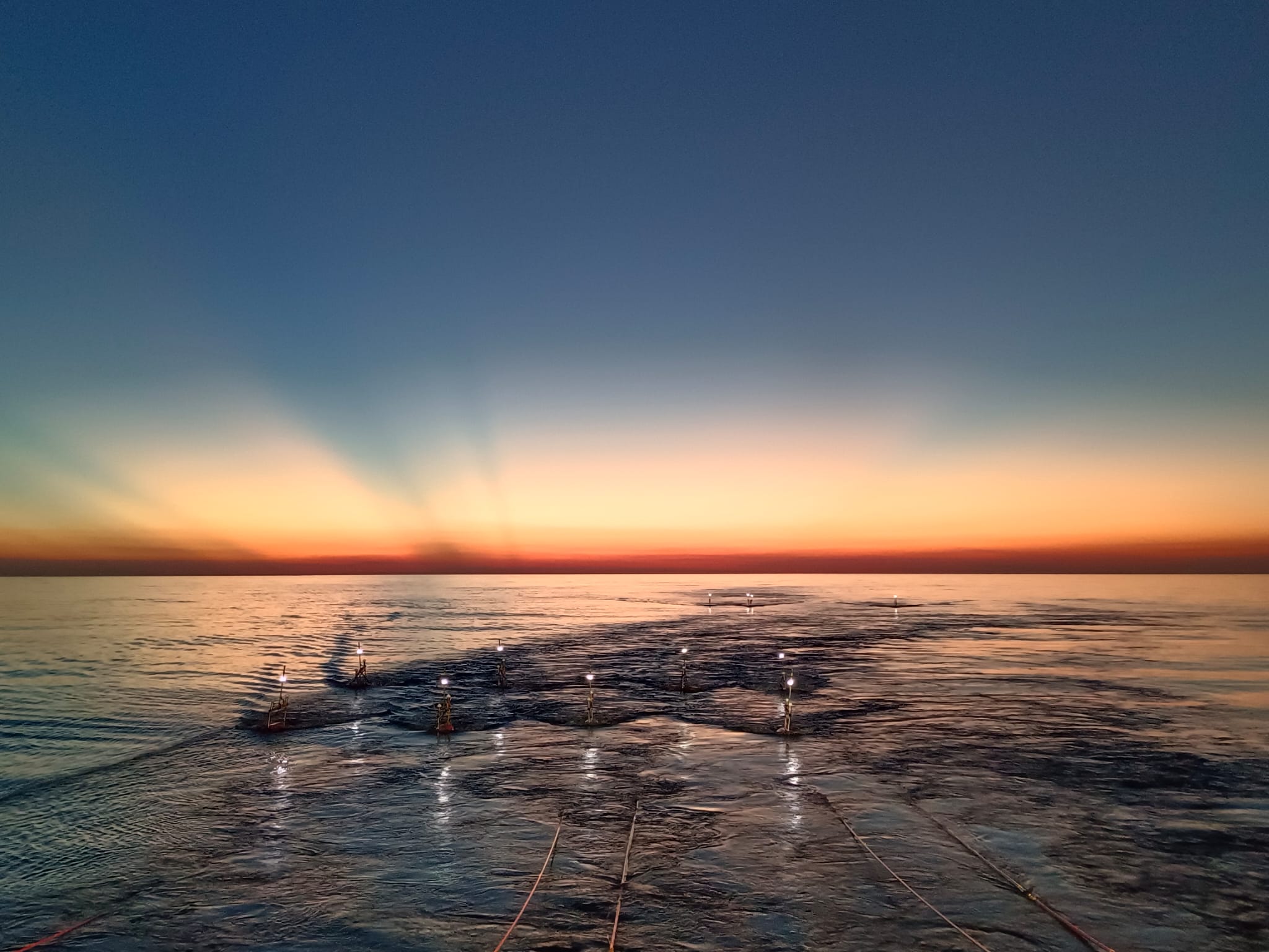
We carefully select the most appropriate systems based on project specifications and site-specific conditions. Our approach includes designing optimized line plans, defining acquisition parameters, and configuring survey geometry to suit the unique requirements of each environment—ensuring optimal data quality and project efficiency.
We deliver proven, high-performance solutions, including:
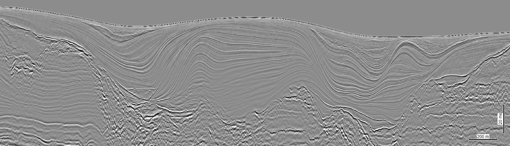
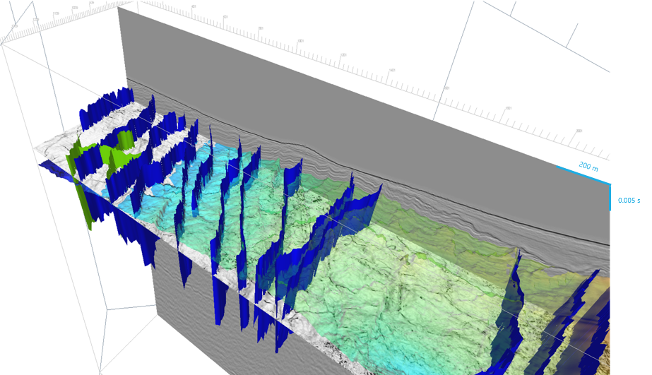
GeoSurveys specializes in the development and application of state-of-the-art processing solutions for 2D and 3D marine Ultra-High Resolution Seismic (UHRS) data. With a strong focus on broadband processing, our goal is to recover the full frequency spectrum of seismic signals—regardless of sea state—ensuring optimal data quality and interpretability.
Our in-house R&D team has developed advanced methodologies for sparker source signature modeling, source and receiver deghosting, and comprehensive static corrections related to seismic datum. These innovations enable the coherent stacking of UHRS data acquired in challenging conditions, including scenarios with source and receiver heave motions exceeding 3 meters (in sea states up to 2 m Hs).
By maintaining full control over survey design and acquisition quality, we ensure the data is ideally suited for advanced processing workflows. These include:
Our integrated approach guarantees data of the highest integrity—delivering meaningful insights, even in the most complex marine environments.
For over 14 years, GeoSurveys and Geo Marine Survey Systems (GMSS) have leveraged their combined expertise to develop advanced 2D and 3D Ultra High-Resolution Seismic (UHRS) systems, delivering comprehensive turnkey solutions to clients worldwide.
Our integrated R&D teams continuously design, test, and refine cutting-edge technologies and methodologies—enhancing both acquisition systems and data processing workflows to meet the evolving demands of the industry.
We support our clients throughout the entire project lifecycle—from the tendering phase to the delivery of fully processed and interpreted results. Our holistic approach ensures the selection of optimal tools and methodologies, aligned with commercial objectives, project timelines, and the highest standards of quality to achieve the client’s goals.
In partnership with Geo Marine Survey Systems, GeoSurveys delivers a full suite of advanced technologies focused on enhancing seismic data imaging. We specialize in high-resolution single- and multichannel 2D and 3D seismic acquisition in both marine and freshwater environments.
Our team brings extensive expertise in the design, planning, and operation of acquisition systems, as well as in data quality control, processing, and interpretation of 2D/3D UHRS surveys. Our solutions have been successfully applied in a wide range of complex and demanding environments—from ultra-shallow waters (2 to 6 meters) to abyssal depths of up to 3,000 meters.
We have experience operating in challenging geological settings, including steep canyon slopes, delta fronts, reef systems, and glacial deposits across the globe—consistently delivering high-quality results in even the most technically demanding conditions.